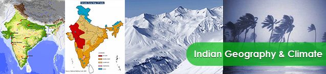
Indian Geography The Union of India is the seventh largest country in the world covering an area of 32,87,590 square kilometers and it is an important country of south Asia.
South Asia has a total area of about 4.488 million sq. km out of which India has the largest area (3.287 sq. km). It occupies 73.2 % of total area.
It is 4 times largest than Pakistan which is second largest in South Asia. India is 12 times largest that UK and 8 times largest than Japan.
The mainland stretches from latitude 8°4′ north to 37°6′ north and from longitude 68°7′ east to 97°25′ east of Greenwhich. The latitudinal and longitudinal extent of the country is almost same in degrees i.e. about 30 degrees.
The southernmost point in Indian Territory, (in Great Nicobar Islands) is the Indira Point (6°45′ ), while Kanyakumari, also known as Cape Comorin, is the southernmost point of Indian mainland. The country thus lies wholly in the northern and eastern hemispheres.
The 82°30′ E longitude is taken as Standard Time Meridian of India, as it passes through the middle of India (from Naini, near Allahabad.) Hence Naini, Near Allahabad is the Standard Time of India.
The country is of a vast size and measures about 3,214 kilometers from north to south and about 2,933 kilometers from west to east.
Indian Standard Time:- GMT +05:30
Geographical information about India
| Particulars | Description |
|---|---|
| Location | The Indian peninsula is separated from mainland Asia by the Himalayas. The Country is surrounded by the Bay of Bengal in the east, the Arabian Sea in the west, and the Indian Ocean to the south. |
| Geographic Coordinates | Lying entirely in the Northern Hemisphere, the Country extends between 8° 4′ and 37° 6′ latitudes north of the Equator, and 68° 7′ and 97° 25′ longitudes east of it. |
| Indian Standard Time | GMT + 05:30 |
| Area | 3.3 Million sq. km |
| Telephone Country Code | +91 |
| Border Countries | Afghanistan and Pakistan to the north-west; China, Bhutan and Nepal to the north; Myanmar to the east; and Bangladesh to the east of West Bengal. Sri Lanka is separated from India by a narrow channel of sea, formed by Palk Strait and the Gulf of Mannar. |
| Coastline | 7,516.6 km encompassing the mainland, Lakshadweep Islands, and the Andaman & Nicobar Islands. |
| Climate | The climate of India can broadly be classified as a tropical monsoon one. But, in spite of much of the northern part of India lying beyond the tropical zone, the entire country has a tropical climate marked by relatively high temperatures and dry winters. There are four seasons: » Winter (December-February) » Summer (March-June) » South-west monsoon season (June-September) » Post monsoon season (October-November) |
| Terrain | The mainland comprises of four regions, namely the great mountain zone, plains of the Ganga and the Indus, the desert region, and the southern peninsula. |
| Natural Resources | Coal, iron ore, manganese ore, mica, bauxite, petroleum, titanium ore, chromite, natural gas, magnesite, limestone, arable land, dolomite, barytes, kaolin, gypsum, apatite, phosphorite, steatite, fluorite, etc. |
| Natural Hazards | Monsoon floods, flash floods, earthquakes, droughts, and landslides. |
Information about Indian Citizens
| Particulars | Description |
|---|---|
| Population | 1.21 billion people (2011 census) |
| Growth rate: | 1.41% (2009 est.) (93rd) |
| Birth rate: | 22.22 births/1,000 population (2009 est.) |
| Death rate | 6.4 deaths/1,000 population (2009 est.) |
| Life expectancy: | 69.89 years (2009 est.) |
| Fertility rate | 2.68 children born/woman (2010 est.) (82nd) |
| 0-14 years: | 31.1% (male 190,075,426/female 172,799,553) (2009 est.) |
| 15-64 years | 63.6% (male 381,446,079/female 359,802,209) (2009 est.) |
| 65-over: | 5.3% (male 29,364,920/female 32,591,030) (2009 est.) |
| Sex ratio ( 15-64 years ) | 1.06 male(s)/female (2009 est.) |
Comparative Demographics
| Category | Global Ranking | Notes (Reference) |
|---|---|---|
| Area | 7th | as of 2011 |
| Population | 2nd | as of 2011 |
| Population growth rate | 102nd of 212 | as of 2010 |
| Population density (people per square kilometer of land area) | 24th of 212 | as of 2010 |
| Male to Female ratio, at birth | 12th of 214 | as of 2009 |
Information about Indian Government
| Particulars | Description |
|---|---|
| Country Name | Republic of India; Bharat Ganrajya |
| Government Type | Sovereign Socialist Democratic Republic with a Parliamentary system of Government. |
| Capital | New Delhi |
| Administrative Divisions | 28 States and 7 Union Territories. |
| Independence | 15th August 1947 (From the British Colonial Rule) |
| National Days | 26th January (Republic Day) 15th August (Independence Day) 2nd October (Gandhi Jayanti; Mahatma Gandhi’s Birthday) |